Franklin County Engineer Facebook Feed

Franklin County Engineer

As a local public works agency headquartered in Columbus, Ohio, the Franklin County Engineer's Office is responsible for the maintenance and construction of 271 miles of county roadway and 351 county bridges, as well as upkeep of all county ditches, drains, retention basins, and other storm water facilities within the right-of-way of county roads in unincorporated areas. To meet the continuing development and infrastructure needs of Franklin County, the Engineer's Office utilizes the latest technologies for determining and maintaining roadway centerlines and boundaries; retracing and setting new monuments for original public land surveys; preparing geographic information system mapping for real estate tax assessments; and establishing precise countywide horizontal and vertical control to maintain uniformity in construction, surveying, and mapping.
Franklin County Engineer
We're making progress on the West North Broadway Bridge rehabilitation project. Check out the latest update to see how crews are transforming this bridge for motorists, pedestrians, and cyclists.
Franklin County Engineer
We had a blast at the WABA - Westland Area Business Association Independence Parade! Thanks to everyone who joined us as we kicked off the Independence Day holiday and America's 250th celebration. It was a great day with the Westland community!
Franklin County Engineer
Beach Road between Amity Road and Plain City-Georgesville Road has reopened to traffic.

Thank you for your patience during construction. Please note that one additional closure will occur later this summer to complete additional work. Advance notification will be provided before that closure begins.
Franklin County Engineer
Today is International Women in Engineering Day. We are proud to celebrate the talented women engineers and engineering professionals on our team whose expertise, innovation, and dedication help build stronger communities every day.

Thank you for all you do! #WomenInEngineering
Franklin County Engineer
Cooke Road, between Karl Road and Maize Road, is closed, for a City of Columbus waterline installation. The closure will last approximately 90 days, weather permitting.
Franklin County Engineer
Out offices are closed today in observance of Juneteenth.Today, we honor this important day of remembrance, reflection, and celebration of freedom. Our offices will reopen on Monday, June 22, 2026, at 7:00 a.m.
Franklin County Engineer's Office
970 DUBLIN ROAD
COLUMBUS, OHIO 43215
(614) 525-3030
fracoeng@franklincountyengineer.org

Follow Us

Top
 

Surveyor’s Journal Entry Five

Surveyor’s Journal Entry Five

Franklinton and Worthington are the County’s First Towns

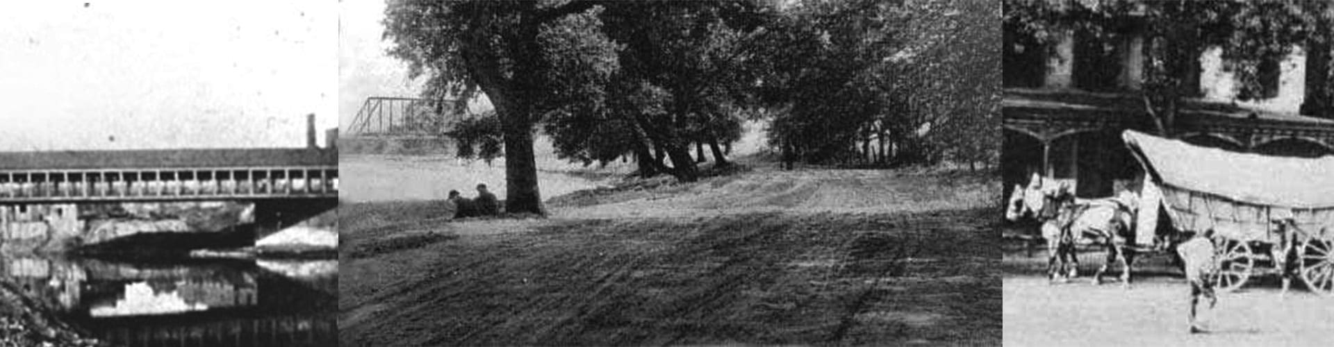
Gift Street was the first thoroughfare laid out in Franklinton by Deputy Surveyor Lucas Sullivant who gifted land around it to encourage settlers to stay in his fledgling community. Despite an abundance of fine farm and grazing land, and wild game, it was difficult, at first, to maintain a consistent populace. Floodwater from the Scioto River washed away many of the original cabins followed by seasonal outbreaks of fever.

By 1801, however, Franklinton’s population grew to the point where a schoolmaster, general store, and grist mill were needed. At the time, land was priced between one and two dollars per acre, making the community an economical destination for pioneers.

The town was laid out in a grid pattern of street blocks that contained fours lots each. The lots were 99 feet wide and 115 feet deep and abutted the rear of the next block. On the outskirts, lots varied in size from 100 to 200 acres.

Eight miles up the Olentangy (Whetstone) River, Deputy Surveyor James Kilbourne (President of The Scioto Land Company of Granby, Connecticut) scouted the sight for the town of Worthington in 1802. He chose 8,000 acres in the U.S. Military District that had been originally surveyed in 1797 by Deputy Surveyor Israel Ludlow (an assistant to Thomas Hutchins from Morristown, New Jersey and one of the founders of Cincinnati).

The town was divided into 160 three quarter acre lots with a 5-acre public green in the center. Farther out, farm lots ranged in size from 20 to 130 acres.

Named initially for the Hamlet of Worthington, Connecticut, it became generally accepted that esteemed Surveyor and Politician Thomas Worthington, who was a close Kilbourne associate, would be the community’s namesake.

By the time Ohio was admitted to the Union as the seventeenth state on March 1, 1803, there were nearly 400 land claims in Franklinton, which served as the county seat until 1824, and 100 in Worthington.